The artificial waterway linking the Yellow, Huai, and Yangtze river systems (Beijing–Hangzhou, some 1,800 km). Emperor Yang of Sui (605–609) knit earlier canals into a continuous whole at enormous human cost; the Yuan later straightened it to run directly to the capital. It was the logistical artery that stitched north and south China into one, moving southern grain and integrating the empire's economy and culture for over a millennium; parts remain navigable today, and it is a World Heritage Site.
All say the Sui fell because of this canal—yet to this day a thousand li rely on its flowing waves.
—— Pi Rixiu, 'Reflecting on the Bian Canal' (Tang)
History
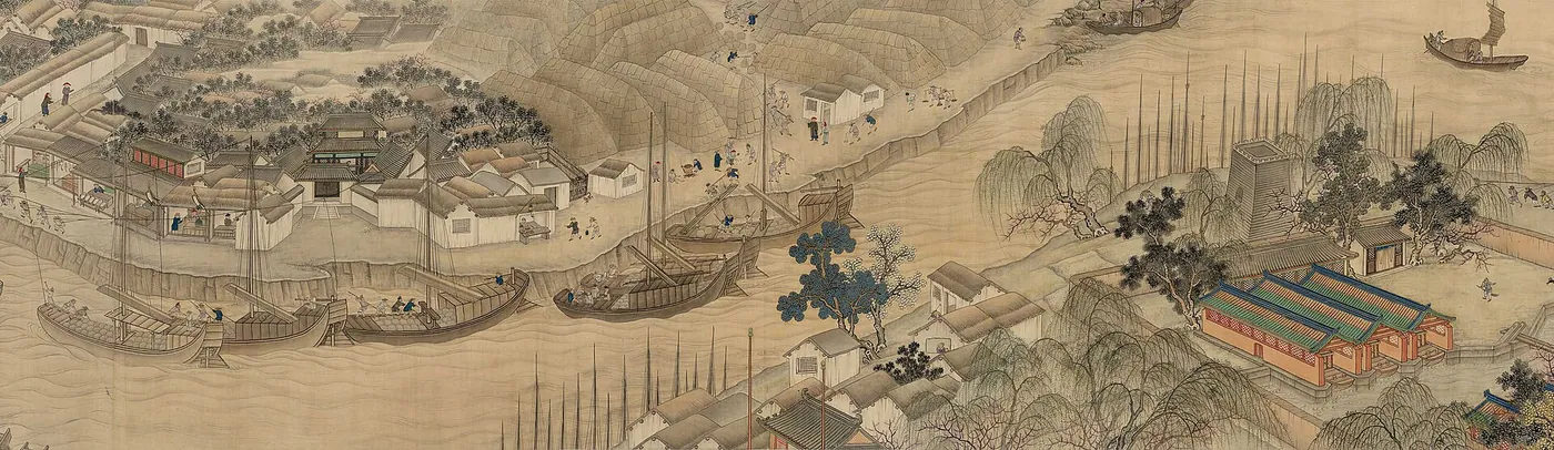
China's economic center of gravity shifted southward to the Yangtze from the Wei-Jin period on, while the political and military center remained in the north—so moving southern grain north became the empire's lifeline. The Grand Canal was made for this. It was no work of a single reign: the Han Gou of the Spring and Autumn era and canals of many dynasties already existed in pieces; in the Daye years (605–609) Emperor Yang of Sui conscripted over a million labourers to link and dredge these into one continuous artery north to south, a vast work at cruel human cost, and one pretext blamed for the Sui's swift fall. Tang and Song rose on this grain transport, the Bian Canal carrying "several million shi of Yangtze-Huai rice a year," with prosperous cities along its banks. The Yuan, capital now at Dadu (Beijing), straightened the canal into a direct Beijing–Hangzhou line of some 1,800 km. Ming and Qing relied on it still. It was the longest artificial waterway of the pre-industrial world, parts navigable today, and a World Heritage Site since 2014.
Connections
Consequences1
- Woodblock Printingenables · disputedBy linking north and south, the canal underpinned the logistics of Song commerce and the book market (the degree is debated)
Echoes1
- The Pyramids of GizaechoesTwo state mobilizations over three thousand years apart, whose technical legacy lies in organizing survey, scheduling, logistics, and accounting rather than in the monument itself
Sources
- 李约瑟(Joseph Needham), 《中国科学技术史·土木工程与航海卷》
- (various), The Grand Canal of China
- Grand Canal (China)
Open questionswell attested
- That Emperor Yang of Sui joined the canal into a through route in 605–609 and that its course was realigned under the Yuan are both confirmed.
- Figures for the dead and injured among the labourers who dug the canal come from later accounts and cannot be precise.
- "The Sui fell because of this canal" is a traditional verdict, and historians also explain the fall by a combination of causes.
Why it matters
The Grand Canal is a superb specimen of the double face of the megaproject, and Pi Rixiu's couplet says it all: everyone blames the Sui's fall on digging the canal, yet a thousand li of grain transport rely on it still—one work can be at once the evidence of tyranny and the bloodstream of a civilization. As a wonder of civil engineering, it must have its cost written down as well: the canal was joined by the forced labour, and deaths, of over a million conscripts, an account that no phrase like "great engineering" may lightly erase. Deeper still, the Grand Canal shows the weight of "infrastructure" in the history of technology: it produced no knowledge itself, yet wove the grain, goods, scholars, and books of north and south into one circulating network, on which the Song's thriving book market and commercial civilization ran. Its relation to woodblock printing should be stated with caution: the canal was not the cause of print, but may have been one of the favourable grounds on which it could spread.